

GIS (Geographic Information Systems) and Remote Sensing courses focus on spatial data analysis, mapping, and earth observation technologies. These courses cover techniques for collecting, analyzing, and visualizing geospatial data using software like ArcGIS, QGIS, and remote sensing tools such as satellite imagery and drones. Applications include environmental monitoring, urban planning, disaster management, agriculture, and natural resource management.
-
 Quick View
3D GIS Training Course
$ 900.00Course Overview This 5-day 3D GIS Training Course equips participants with the skills to leverage 3D GIS technologies for enhanced spatial analysis and visualization. Learn to create, analyze, and interpret... -
 Quick View
3D Terrain Modeling and Visualization Techniques Training Course
$ 900.00Course Overview Understanding terrain is crucial in fields like urban planning, environmental science, and infrastructure development. This 5-day hands-on training offered by Relan equips participants with the skills to create,... -
 Quick View
Advanced GIS Data Modeling and Spatial Algorithms with Python and PostGIS
$ 1,800.00Course Overview 🌍 Geographic Information Systems (GIS) rely on robust data models, structures, and algorithms for efficient spatial data management and analysis. 🗺️ This comprehensive 10-day course explores advanced GIS... -
 Quick View
Advanced GIS Server Administration (GeoServer II) Training Course
$ 900.00Course Overview This 5-day course offered by Relan teaches advanced GeoServer administration, including data publishing, configuring web services, applying filters, and using GeoWebCache. Participants will also learn security settings and... -
 Quick View
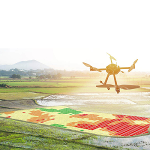
Drone Mapping and RTK Training Course
$ 1,800.00Course Overview 🚁 This 10-day course offered by Relan introduces participants to the use of drones for mapping and modeling, transforming industries like land surveying, construction, and mining. Learn essential... -
 Quick View
GIS for Spatial Planning Training Course
$ 900.00Course Overview Offered by Relan, this 5-day course provides essential GIS skills for land-use planning, urban development, and environmental conservation. Learn to apply GIS tools for site analysis, zoning, and... -
 Quick View
GIS Web Development with GeoJSON Training Course
$ 900.00Course Overview This 5-day course offered by Relan equips participants with advanced skills in web-based GIS using GeoJSON, focusing on spatial data manipulation and visualization. Learners will gain hands-on experience... -
 Quick View
Google Earth Engine Mastery Training Course
$ 900.00Course Overview 🚀 Master Google Earth Engine in this 5-day advanced training course offered by Relan! Learn to analyze satellite imagery 🛰️, automate workflows 🤖 with JavaScript, and apply machine... -
 Quick View
MapInfo Professional Training Course
$ 900.00Course Overview Enhance your GIS skills with our 5-day advanced Professional training offered by Relan. Learn spatial analysis, database management, raster & vector data handling, SQL selections, and advanced mapping...